This item has been sold, but you can enter your email address to be notified if another example becomes available.


|
||

|

|
|

|
Stock# 39224
Description
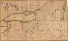
Detailed map of the lands between the Mohawk River and Wood Creek, based upon a manuscript sketch which was then in the collection of the New York State Library in Albany.
Among the more interesting features on the map are the locations of:
- Fort Graven (burnt by General Webb)
- Fort Williams
- Fort Stanwix
- Fort Newport
- An Oswegogie Indian Path
These forts guarded an important portage between the Mohawk River and Wood Creek, known as the Oneida Carry, along the important trade route between Albany and Lake Ontario. The region was the site of several important battles during the French and Indian War. Fort Stanwix, built by the British in 1758, was later occupied by the Continental Army during the American Revolutionary War.
Condition Description
Minor foxing
![Map of the State of New York with Part of Upper Canada [Large inset plan of New York]](https://storage.googleapis.com/raremaps/img/small/91848.jpg)
![[ Inhabitants of New Netherlands ] Einwohner in Neu Niederland](https://storage.googleapis.com/raremaps/img/small/94087.jpg)