


|
||

|

|
|

|
The map is based upon surveys conducted by Washington Hood, shortly before his death. Shows area to the west of the Mississippi, from Fort Snelling to the Gulf of Mexico.
The map was one of 2 maps, which was part of a report of the Secretary of War, with plans for the defense and protection of the western frontiers of the United States and statements of the number of Indians and warriors on those frontiers [p. 777-786]. Many tribes that will be moved to Indian Territory are shown. Published in Report from the Secretary of War ... in Relation to the Protection of the Western Frontier … January 3, 1838. Senate Document 65, p. 2, Serial 314.
The two maps show the different proposals for the "defenses" of the Mississippi River Valley and Transmississippi West. Emphasis is placed on the Road System beginning in the south at Baton Rouge, and the Coshatta Village and extending north to Jefferson Barracks, Ft. Leavenworth, and Ft Calhoun, then on to Fond du Lac.
The area covered extends from the Mississippi River to the Rockies. U. S. Army forts are shown; most are 150 or more miles west of the Mississippi. Fort Snelling is the northern-most; Ft. Jackson, the southern-most. Indian tribal lands are identified. A few roads are shown.
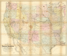
A fascinating early map of the Trans-Mississippi West.


![Carte De La Louisiane Et Du Cours Du Mississipi . . . Juin 1718 [1st State!]](https://storage.googleapis.com/raremaps/img/small/59797.jpg)
![A Map of Lewis and Clark's Track Across the Western Portion of North America, from the Mississippi to the Pacific Ocean. By Order of the Executive of the United States in 1804, 5 & 6. . . . [Complete with 3 volumes of Text: Travels to the Source of the Missouri River and Across the American Continent to the Pacific Ocean. Performed by Order of the Government of the United States, in the Years 1804, 1805, and 1806].](https://storage.googleapis.com/raremaps/img/small/81775.jpg)