|
||

|

|
|

|
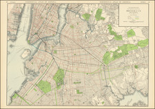
Rare French battle plan depicting the August 27, 1776 Battle of Long Island, in which a huge British force humiliated George Washington and the Continental Army. Offered here in an unrecorded early state, with manuscript additions.
The map depicts the British frontal attack on the American army entrenched on Brooklyn Heights and the famous "end run" through the Jamaica Pass that took the Americans' flank and forced their retreat to the Hudson. The only bright spots of the battle were an almost unbelievably brave holding action at the Gowanus Heights by a Maryland regiment under William Alexander (the self-styled "Lord Stirling") and the successful evacuation of the battered American forces to Manhattan in poor weather on the night of the 29th.
As noted by Michael Buehler of Boston Rare Maps:
This example is interesting for being an unrecorded early state of the map. The table of references identifies only 9 items, instead of the 12 mentioned cited by Nebenzahl, and the map lacks several details that appear on the copy in the Rochambeau Collection at the Library of Congress.