


|
||

|

|
|

|
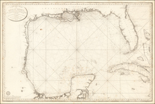
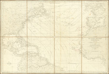
Scarce map of the Virgin Islands, which appeared in the J ournal of the Royal Geographical Society and is credited to R.H.Schomburgk at the bottom left.
An interesting separate presentation of the Virgin Islands, extending from Green and Brigantine Islands just east of St. Thomas to Virgin Gorda in the west. Red and blue colored lines depict the flow of the flood and ebb tides. In addition, areas of heavy swell and ground swell are indicated by shading. While towns are not indicated, numerous island, "kays" and points are identified.
Schomburgk, a German-born and educated British explorer and surveyor, first visited the Virgin Islands in 1831 at the age of 27. Subsequently, he undertook explorations and surveys of British Guiana, Barbados, the Dominican Republic and Thailand.
This is one of the few maps of the Virgin Islands printed in the first half of the 19th Century.
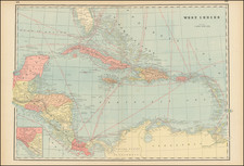
![Colton's West Indies [Bermuda and Havana insets]](https://storage.googleapis.com/raremaps/img/small/67374.jpg)