


|
||

|

|
|

|
Rare separately issued map of Canada depicting the nature and organization of the Roman Catholic population, published as a supplement to the Journal les Missions Catholiques, in Paris.
The map focuses on the various Roman Catholic Dioceses in Canada, identifying 33 separate dioceses and apostoliques, which are divided between:
- Dioceses
- Vicariates apostoliques
- Prefecture apostoliques
A total of 2,138,500 Roman Catholics are noted in Canada (out of a total population of 4,931,000), with population broken down by regions. Not surprisingly, Quebec accounted for almost two-thirds of Canada's Catholic population, with large percentages also in New Brunswick and Newfoundland (which was still a separate colony from Canada, not joining the Confederation until 1949). The map also identifies the recently completed Canadian Pacific Railway, its principal branches and the limits of the various dioceses, vicariates, prefectures, the residences of the archbishops, and etc.
While almost immaterial today, religion was a very heated topic in late 19th Century Canada. Canadian Confederation was a bold, yet audacious experiment, uniting a largely Francophone Catholic society with largely Anglophone Protestant realms. While the British North America Act (1867) granted educational funding and political rights to Roman Catholics in largely Protestant provinces (like Ontario), discrimination was still rife in many areas of Canada. Roman Catholic ecclesiastical leaders and prominent Catholic Canadian officials felt a need to ensure that their interests were protected. The maker of the map, Georges-Frédéric Baillairgé (1824-1909) was, in addition to being a former Federal Deputy Minister of Public Works, a publisher and leading advocate of Catholic and French Canadian rights. This map would have been a useful administrative tool for Catholic stakeholders to assess the strength of the Church in various regions of Canada, so as to plan where to marshall resources.
The map is a fascinating and markedly sophisticated example of 19th Century thematic and demographic cartography in 19th Century Canada.
The map is quite rare. We note only the copies at the BNF and the Canadian National Archives.
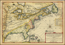
![[French & Indian War] Carte Des Possessions Francoises et Angloises dans le Canada et Partie de la Louisiane . . . 1756](https://storage.googleapis.com/raremaps/img/small/94026.jpg)


![[MacKenzie River, Yukon Territory and Northwest Territory] Amer. Sep. No. 15. Grand Lac De L'Esclave](https://storage.googleapis.com/raremaps/img/small/19469.jpg)