This item has been sold, but you can enter your email address to be notified if another example becomes available.


|
||

|

|
|

|
Stock# 37565
Description
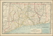
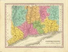
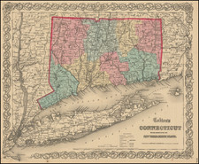
Strikingly colored separately issued map of the State of Connecticut, hand colored by townships.
Includes inset maps of Hartford, New Haven and New England, along a list of the Governors of Connecticut up to 1858 and a reference key, identifying:
- County Lines
- Town Lines
- Turnpike Roads
- Common Roads
- Places of Public Worship
- Court Houses
- Canals
- Railroads