
This item has been sold, but you can enter your email address to be notified if another example becomes available.


|
||

|

|
|

|
Stock# 3658
Description
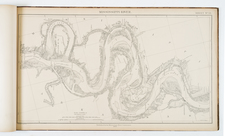
Marvelous regional map, showing the early counties, towns, roads and Indian details. The northwestern portion of Gerogia is still largely unsettled Cherokee land without counties. Northeastern Alabama is dominated by Creek lands. One of the Southern counties of Tennessee is also unnamed. Many forts, Indian Villages and other landmarks identified throughout the map. Information key notes abbreviations for Bridges, Court Houses, Churches, Creeks, Forks, Lakes, Mountains, Post Offices, Points, Springs, Swamps & Villages, Indian Villages, Forts, etc.


![(Southeast United States) Carte de la partie sud, des Etats Unis de L' amerique septentrionale [Map of the southern part of the United States of North America]](https://storage.googleapis.com/raremaps/img/small/98738.jpg)

![Notes on the State of Virginia [with the map:] A Map of the country between Albemarle Sound, and Lake Erie, comprehending the whole of Virginia, Maryland, Delaware, and Pensylvania, with parts of several other of the United States of America. Engraved for the Notes on Virginia.](https://storage.googleapis.com/raremaps/img/small/55181.jpg)