|
||

|

|
|

|
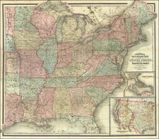
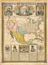
Rare early coast to coast map of the United States based on the maps by Arrowsmith and Melish, with information from the Lewis & Clark and Humbolt's expeditions.
The map includes several highly unusual features, including the Nouvelles Philippines ou Texas. The single Cordillera style Rocky Mountains derives from Humboldt. The two mythical great lakes are shown (Timpanagos and Teguayo), with a river connecting them to San Francisco Bay. An interesting mountain range extends from Northern California to the Rocky Mountains.
The Columbia River Basin shows an excellent integration of the information provided by Lewis & Clark. As is frequently the case with French maps of the period, the American claims extending to 54 degrees-40 minutes is shown, a boundary claim hotly contested by the British during the first half of the 19th Century.
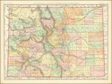
West of the Mississippi, the Spanish Land Districts are still shown, including St. Louis, Girardeau and Lawrence, along with a double wide Arkansas Territory and massive Louisiana Territory, pre-dating the creation of the state of Missouri. Illinois is pushed far to the west of its true location, with Indiana appearing under Lake Michigan. Massive Northwest Territory, pre-dating Wisconsin, Minnesota and Iowa. Les Florides are shown (East and West), an unchanged reference to the time period before Florida's becoming a U.S. Territory in 1821.
Remarkable treatment of the Transmississippi West. A fabulous map, which rarely appears on the market.