|
||

|

|
|

|
Rare separately-issued profile view / sea chart of St. Helena, published by Johannes Van Keulen in Amsterdam, circa 1735.
This fine sea chart provides a remarkably detailed topographical perspective view of the northern side of the island, from Zuykerbroods punt (Sugar Loaf Point) to Paarde-wyde-hoeck (Southwest Point). The view is centered on Munden's Fort, the site of Jamestown, while a numbered key identifies the numerous fortifications and and batteries, while the sea includes extensive soundings and other notes.
St. Helena is a small island in the South Atlantic lying strategically along the main shipping route from Europe to the Cape of Good Hope, and as such for over 500 years it has acted as a refuge for mariners. While discovered by the Portuguese in 1502 and claimed by the Dutch in 1633, the English were the first to settle the island in 1659. St. Helena was considered to be the property of the English East India Company, and by the time this chart was made it had 1,100 residents (1723 census). The island was the most important revictualling point for British traders en route to India and East Asia, such that detailed sea charts like the present maps depicting the appraoches to Jamestown, the island's only harbor, would have been of considerably value during their time. Later on, St. Helena was of course famous as Napoleon Bonaparte's place of exile from 1815 to 1821.
The chart is exceedingly rare, as is the case with most separately-issued sea charts from this period. We find mention of it listed as a separately issued map in G.D. Bon's Bijdragen Tot Eeene Geschiedenis Van Het Geslacht "Van Keulen" (Amsterdam, 1885), at page 18, within the Section entitled 'Atlassen en Kaarten . . . 1678-1757'.
The Van Keulens were a family of chartmakers and publishers. The firm, In de Gekroonde Lootsman (In the Crowned Pilot), was founded in 1678 by Johannes van Keulen (1654-1715). Van Keulen originally registered his business as a vendor of books and instruments (specifically cross-staffs). In 1680, however, he gained a privilege from the States of Holland and West Friesland for the publication of pilot guides and sea atlases.
In that year, van Keulen released his Zee-Atlas (Sea Atlas), which secured him a name in the competitive maritime publishing market. In 1681, he published the first volume of Nieuwe Lichtende Zee-Fakkel (New Shining Sea Torch). This would be the first of an eventual five volumes originally published between 1680 and 1684. A sixth volume was added in 1753. The Zee-Fakel won van Keulen lasting fame. The atlas had charts compiled by Claes Jansz Vooght and artwork from Jan Luyken. It proved immensely popular and was reprinted until 1783. There were translations in French, English, Spanish, and Italian.
The late-seventeenth century was an auspicious time to enter the maritime chart business. Previous industry leaders had either closed shop, died, or retired, leaving space for a new competitor. Van Keulen proceeded to buy up the stock and privileges of several maritime publishing firms; the most notable was the stock of Hendrik Doncker, acquired in 1693.
Johannes’ son, Gerard (1678-1726) took over the business upon his father’s death. Gerard was a skilled engraver and mathematician. His talents were noticed, as in 1706 he was named as Hydrographer to the Dutch East India Company (VOC).
In turn, Gerard’s son Johannes II (1704-1770) came to run the shop. He was also tied to the VOC, and his role as their chartmaker allowed his charts to be considered as quasi-official government documents. It is with access to formerly clandestine VOC geographic knowledge that Johannes the Younger was able to add a sixth volume to the Zee-Fakkel, which covered the East Indies. Johannes also continued to sell instruments, including the recently-invented Hadley’s Quadrant from 1744.
When Johannes II died in 1770, his widow ran the business in his stead, aided by her two sons, Cornelis Buys (1736-1778) and Gerard Hulst (1733-1801). Now a century old, the family business had extended to include an anchor factory. After Cornelis died in 1778, Gerard took on the management of the firm alone. He oversaw the introduction of sextants to their inventory and published the Dutch Nautical Almanac beginning in 1788. Annual editions appeared until 1885. Gerard also served as an original member of the Dutch Commission for Longitude at Sea from 1787.
Gerard’s widow ran the business for nine years after his death, when their son, Johannes Hulst, started to lead the firm in 1810. After his death in 1844, the firm passed out of family hands and into the control of Jacob Swert, a skilled cartographer who had worked for the business for two decades. He passed the work to his son, another Jacob, in 1866. By the mid-nineteenth century, the conversion from sail to steam had diminished the size of the market for charts. Fewer sailors needed fewer maps, charts, and instruments. In 1885, after 207 years in business, In de Gekroonde Lootsman closed its doors and auctioned its stock.
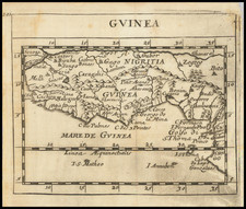
![[ Sierra Leone to Côte d'Ivoire ] Pas-caert vande Gryen-Cust en Adaows Qua Quaas Tuhessen de Serraliones en C. de Tres Puntas . . . .](https://storage.googleapis.com/raremaps/img/small/99332.jpg)