|
||

|

|
|

|
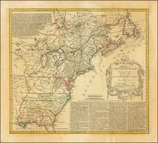
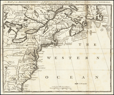
Fine example of Fisher, Son & Co.'s scarce map of the United States, which is most notable as being probably the last appearance of Franklinia as a state.
Georgia still runs to Mississippi. Immense Western Territory and Louisiana Territory.
Perhaps the most unique feature of this map is the inclusion of "Franklinia," to the west of North Carolina. In fact, this short lived breakaway "state" was located between North Carolina and Tennessee, as noted below.
In the latter part of the 18th Century, the settlers in Western North Carolina and Eastern Tennessee decided that because of poor representation in State Government, they needed to form a state of their own. A government was formed and initial organizational meetings conducted, but the breakaway state was quickly subdued by the North Carolina authorities, although not before the State of Franklinia began appearing on a number of English and German maps during the period. Ben Franklin himself responded that while he was honored by the decision to name a state after him, he was not able to relocate.
This is the latest example of the map we have ever seen. More normally, the map is dated circa 1820.
![Colton's United States of America [State of Colona named]](https://storage.googleapis.com/raremaps/img/small/90086.jpg)