This item has been sold, but you can enter your email address to be notified if another example becomes available.


|
||

|

|
|

|
Stock# 3453
Description
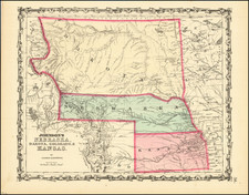
A scarce map of Colorado, handcolored by county. Page's map is almost certainly the largest handcolored map of Colorado to appear in an atlas. The map shows the extent of theTownship surveys and includes towns, mountains, rivers, forts, mines, roads, railroads etc. A hard to find map in nice condition, save for some minor reinforced damage at the centerfold.
![[Geology Map of the Texas, California & the Southwest] Esquisse Geologique Des Anciennes Possessions Mexicains Du Nord Incorporees Ala Federation des Etats-Unis . . . 1867](https://storage.googleapis.com/raremaps/img/small/71446.jpg)
![Map of the Missouri Pacific and St. Louis, Iron Mountain and Southern Railway and Connections [Missouri Pacific Railway. St. Louis & All Points East Chair Cars Free Fast Mail Route]](https://storage.googleapis.com/raremaps/img/small/91606.jpg)