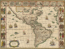
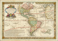
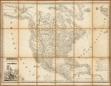
|
||

|

|
|

|
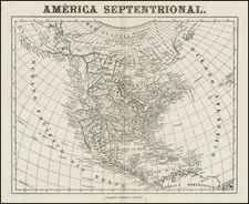
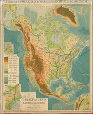
Fine example of Martin Kunz's Braille map of North America, published in 1888.
Martin Kunz (1847-1923), was the director of the Illzach bei Mülhausen Institute for the blind from the 1880s until the turn of the century, where he became the dominant force in the publication of Tactile maps and illustration for the blind. The pictures and maps he produced were used in blind institutes throughout Europe, as well as in England, Australia, and North America.
Kunz also published relief pictures for the teaching of physics, botany and zoology.
As noted in Encyclopädischen Handbuch des Blindenwesen
In 1877, K. was awarded a prize for the plastic maps which he presented at the Geographic Exhibition in Berlin; he was also awarded prizes in Paris and in many other places. The layered relief sheets produced by the pupils in Genau were later used in the first printing tests in Illzach, which eventually led to the publication of K's three-dimensional repetition atlases for the sighted. This atlas is now in used in many secondary schools in Germany and in other countries. Their creator received one of the few prizes awarded at the Geographic World Congress in Bern in 1891...On account of his work, K. has earned himself a place in the history of the blind; he did away with the individual teaching of geography which was common at the time, as it thus became possible for the poorer institutes to acquire maps for each pupil and to teach geography on a much larger scale.
According to Johannes Moldenhawer, Kunz drew upon a method which had been developed by the Guldberg in Denmark:
Using a method invented by himself for pressing (cardboard) between an elevated and a depressed mould, he manufactured excellent relief maps of Denmark and Western Europe (Eastern Europe was added later). These maps, the first really efficient paper relief maps for use in schools and a copy of which each pupil in the class could be given, aroused great interest in other countries, after being exhibited at the first congress for teachers of the blind. The institute in Copenhagen itself received a number of orders. Mr. Guldberg, however, could not take upon himself a larger production of relief maps on paper and their manufacture was therefore passed on to others, that is, to Dir. Kunz at the institute for the blind in Illzach, Elsass. In England relief maps of this type were also made.
Tactile maps use raised and depressed surfaces, as well as a variety of textures, to indicate geographic features and boundaries. In the latter part of the 18th century, R. Weisenberg of Mannheim, Germany, experimented with maps made tangible by the application of various materials, such as pieces of glass and water, and later silk threads of various dimensions, but these proved to be impractical or to tear too easily. Prior to the 1830s tactile maps were usually custom-made for a few individuals who were blind.
In 1837, Samuel Gridley Howe commissioned Stephen Preston Ruggles to make a large tactile Globe. In concept and size the globe is a minor milestone in map-making with its 13-foot circumference and construction from over 600 pieces of wood. Ruggles also made several tactile maps made of carved wood and a variety of additional materials. Howe was among the first to develop methods that allowed for the production of tactile maps in quantity. Perkins embossed paper maps that were published as atlases in the 1830s.