This item has been sold, but you can enter your email address to be notified if another example becomes available.


|
||

|

|
|

|
Stock# 33774
Description
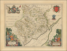
Nice example of Cruchley's pocket map of Cornwall.
Detailed map of Cornwall on a scale of four miles to the inch, showing new railway lines extending to Penzance and St. Ives, with further detail of the polling places, the borough boundaries and indications of boroughs returning one or two members to parliament, etc.
The map is based upon John Cary's map, published at the end of the 18th Century.
Condition Description
Folding map with original printed covers