This item has been sold, but you can enter your email address to be notified if another example becomes available.


|
||

|

|
|

|
Stock# 32357mb
Description
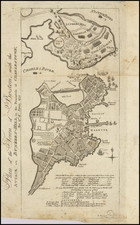
Fine exmple of H.F. Walling's detailed map of the town of Raynham in Bristol County, Massachusetts.
The map is hand colored by wards and shows remarkable topographical detail for the period.
Includes a note about the city below the title, including information on its incorporation in 1731, distance from Boston, establishment of the first forge in 1832 by James & Henry Leonard and the location of King Philip's House. King Philip, also known as Metacomet, was an Indian Chief who led the Indians of the area against the English colonists in a conflict which would come to be known as King Philip's War (1675 to 1678). The note goes on to mention that King Philip used the house as a hunting lodge, until he was killed by an Indian named Alderman.
Condition Description
Wall Map--nearly flawless condition
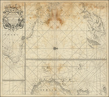
![[British Colonies in America] Carte Qui Contient Une Description Des Iles & Terres Que Les Anglois . . .[maps of Chesapeake, Carolinas, New England, Bermuda, Gulf Coast, Jamaica, Barbadoes & Canada]](https://storage.googleapis.com/raremaps/img/small/61480.jpg)