This item has been sold, but you can enter your email address to be notified if another example becomes available.


|
||

|

|
|

|
Stock# 31987
Description
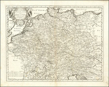
Rare map of Poland, showing the Kingdom, with large portions now controlled by Russia, Prussia and Austra, published by Jan Elwe in Amsterdam.
The map provides a fine look at the country at the end of the 18th Century, with a large decorative cartouche.
This is the rare sixth state of the map, which was first issued by Hubert Jaillot in 1694.
Reference
Kozica K. , Imago Poloniae (from Dr T. Niewodniczanski's collection), Vol.2. pos. K19/6 .
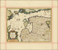
![[ Estonia, Latvia, Lithuania ] Ducatuum Estoniae et Livoniae Tabula cum cursu Fluvii Dwinae](https://storage.googleapis.com/raremaps/img/small/62142.jpg)