


|
||

|

|
|

|
Rare map of St. Augustine, published by Le Rouge in the Pilote Americain Septentrionale in 1778 for use by the French Navy during the American Revolution.
Following the commencement of the American Revolution, France initially played a passive support role on behalf of the American colonist. While some French important French officers, including Lafayette and Pierre L'Enfant joined the Americans as volunteers, for the first two years, the French primarily provided military and other supplies to the Americans. Ultimately, in 1778, following several years of diplomatic efforts by Benjamin Franklin and others, France formally recognized the United States on February 6, 1778, which was followed shortly thereafter by Britain's declaration of war on France on March 17, 1778.
France's initial involvement in the war in North America was an unsuccessful attempt to capture Newport, Rhode Island, which was then under British occupation.
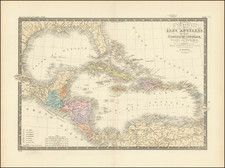
In support of France's new military interests in North America, George Louis Le Rouge, then mapmaker to King Louis XVI, set out to create a set of sea charts of North America for use by the French Navy. Le Rouge's Pilote Americain Septentrionale drew heavily upon the work of William Faden and Thomas Jefferys, utilizing a series of maps first published in 1775 under the title North American Pilot, which consisted of 2 volumes, one focusing on Canadian waters and the second focusing on what would become the 13 Colonies. The maps were modified with French nomenclature and sailing directions and improved where better information was available.
Because its primary purpose was as a military atlas designed for use at sea by the French Navy, very few examples of the Pilote Americain Septentrionale have survived, even fewer in good condition, and the individual maps from this atlas rarely appear on the market. The last complete copy of the atlas to appear at auction was sold at Sothebys in 1948.
George-Louis Le Rouge (1712-1790), though known for his work in Paris, was originally born Georg Ludwig of Hanover, Germany. He grew up and was educated in Hanover, after which he became a surveyor and military engineer. Around 1740, however, Le Rouge moved to Paris and set up shop as an engraver and publisher on the Rue des Grands Augustins. It was at this time that he changed his name, adopting a French pseudonym that would later become quite famous.
Le Rouge spent much of his forty-year career translating various works from English to French, and his cartographic influence often came from English maps. His experience as a surveyor and engineer in Germany made him a skilled and prolific cartographer, and he produced thousands of charts, maps, atlases, and plans. His work spans from garden views and small-town plans to huge, multiple-continent maps. Le Rouge eventually accepted the position of Geographical Engineer for Louid XV, the King of France.
Later in life, Le Rouge became well-known for publishing North American maps, such as in his Atlas ameriquain septentrional of 1778. One of Le Rouge’s other more famous works is the Franklin/Folger chart of the Gulf Stream, which he worked on with Benjamin Franklin. Franklin and Le Rouge corresponded around 1780 and collaborated to create this map, a French version of Franklin’s famous chart which was originally printed in 1769.
![(The First Letter From British Florida) [September 5, 1763, Autograph Letter, Signed, from Robert Campbell to John Campbell, 4th Earl of Loudoun, describing the British taking possession of Florida and the state of the settlement of Pensacola]](https://storage.googleapis.com/raremaps/img/small/86620.jpg)
![[ Florida Native Americans Declaring War ] Bellum denunciandi ratio. XXXIII.](https://storage.googleapis.com/raremaps/img/small/98006.jpg)
![[ Georgia Coast ] Sex alia flumina a Gallis observata. IIII.](https://storage.googleapis.com/raremaps/img/small/97965.jpg)
![[Florida/Georgia -- Mouth of St. Mary's River] Plan of Amelia Island In East Florida; A Chart of The Entrance Into St. Mary's River; A Chart of The Mouth of Nassau Rivers. By Captain William Fuller. 1770](https://storage.googleapis.com/raremaps/img/small/40410.jpg)