|
||

|

|
|

|
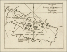
Fine large format map of Jamaica, engraved by Robert Scott in Edinburgh, utilizing the surveys of James Robertson.
James Robertson of Gossaburgh, Shetland Islands, Scotland (1753-1829) conducted a survey of Jamaica from 1797 to 1804, upon which one commentator enthusiastically noted "this survey constitutes one of the very first detailed topographical map series of an entire country in the world , and that of an accuracy and quality unsurpassed until long past the middle of the 19th century."
Robertson's orginal map is especially important for historians because it shows the names of the major property owners and the property locations during the years 1797 to 1804. The original Robertson map was published in three parts, one for each County, each "inscribed" to a different Royal Duke. Each part was copied in 6 sheets (each about 22" x 30").