|
||

|

|
|

|
Some of the first Anglo groups to settle in the area were the families of John, Silas, and Ben Parker, all of whom helped build a fort near the site of present Groesbeck (Limestone County) in 1833. This fort was attacked on May 19, 1836, and all of the settlers were either killed or taken captive.
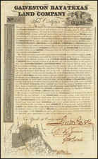
Rare separately issued map of Navarro, Texas, centered on Corsicana, published by the Texas General Land Office in 1888.
The map is a remarkably detailed cadastral map, showing property tracts, landowners, land patents, railroads, and towns; portions of adjacent counties where property boundaries extend beyond the county limits. The map also includes recorded volume and dates for some properties.
The map was prepared by R.M. Hall, Commissioner of the General Land Office of Texas and bears his signature in facsimile.
OCLC lists only a single institutional copy of this map (University of Texas, Arlington). One of the earliest extent maps of Navarro County, the earliest in the Texas Land Office dating to 1871, with OCLC listing only 1 earlier map, known in 2 copies.
In the spring of 1846 a group of local land owners, Texas Ranger Edward Tarrant, petitioned the state to form a new county from a portion of Robertson County. Clinton M. Winkler, a local lawyer, presented the petition to the state legislature in Austin, and it was approved on April 25, 1846. The new county included all the portions of Robertson County within the east bank of the Brazos River to the northwest corner of Limestone County. It also extended to the Trinity River and north to Dallas County.
The county was named for José Antonio Navarro (1795-1871), one of the most prominent Mexican supporters of Texas Independence. Navarro was one of three Mexican signers of the Texas Declaration of Independence. The earliest settlement began in 1838 with Dr. George W. Hill, shortly followed by the development of Peters' and Mercer Colonies. The map identifies the grant given to Thomas Jefferson Chambers in 1834 by the Mexican Government, prior to Independence. A number of other early grants are listed, including Rachel Leach (October 27, 1835), Jehu Peoples (October 11, 1835), John Taylor (October 12, 1835), Enoch Frier (October 11, 1835), Michael Shire (October 12, 1835), Jerimiah Latham (October 12, 1835), John McNeal (October 15, 1835), Martin Latham (October 5, 1835), John Choat (October 185h 1835) and R. B. Longbotham (July 24, 1835).
Navarro County was the site of the famous Parker family fort, and the site of the Comanche raid in May 1836, which resulted in the capture of several members of the Parker clan, and later the publication of several of the most famous narratives of Indian Captivity from the period.
![[Early Texas Aeronautical Navigation Map] Aeronautical Map For Cross Country . . Drawn by Cpl. V.G. Smylie Aero Squadron, Ellington Field](https://storage.googleapis.com/raremaps/img/small/59678.jpg)
![(Dallas, Texas) USAF Target Complex Mosaic-Series 25 [Sheets 0 - 4]](https://storage.googleapis.com/raremaps/img/small/87119.jpg)