This item has been sold, but you can enter your email address to be notified if another example becomes available.


|
||

|

|
|

|
Stock# 31015
Description
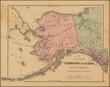
Rare illustrated map of Alaska and the Bering Straits, which appeared in the first German edition of the Account of Cook's Voyages.
The map covers the area from the Bering Strait and the coast south of Norton Sound to the coast north of Cap du Prince de Galles. The coastline is well presented with hachure showing mountains, sections of coastlines and islands with place names and soundings. Isles de Clerke is partially shown. The tracks of the 1778 and 1779 exploration are shown, Cook having done the former and Clerke the latter after Cook's death in Hawaii in Feb. 1779.
The maps from the German edition are very rare on the market and the only edition to include illustrations on the map.
![[Alaska] Das Russische Amerika.](https://storage.googleapis.com/raremaps/img/small/95557.jpg)
![[Alaska to San Diego and San Qunitin, British Columbia] A Chart Shewing Part of the Coast of N.W. America, with the Tracks of His Majesty's Sloop Discovery and Armed Tender Chatham . . . (First Modern Map of the West Coast of North America)](https://storage.googleapis.com/raremaps/img/small/102067.jpg)
![Carte des parties Nord et Est de L'Asie qui comprend les costes de Russie asiatique le Kamschatka, le Iesso et les isles du Japon…[insets of Alaska, West, AZ and Conibas]](https://storage.googleapis.com/raremaps/img/small/84040.jpg)