|
||

|

|
|

|
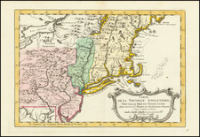
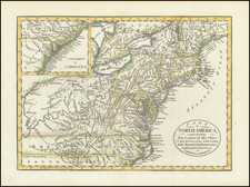
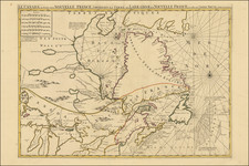
Interesting set of 4 different engravings, joined by an early owner on a single sheet, with manuscript additions.
Each of the 4 maps is a reduced size image of an important early Colonial Map and view. The map is a reduction of Bowle's One-Sheet map of the seat of war. The plan of Boston and the Plan of Boston Harbor are drawn from Des Barres and Sayer & Bennett's maps.
The view of Boston is taken from Pownall's very rare view of the same title, published in 1768, which later appeared in the Universal Magazine in 1775. The view is taken from Cambridge looking across the Charles River to the Boston Common. Governor Thomas Pownall was credited with making a first draft, then had it painted by a "Mr. Pugh" and engraved by Pierre Canot for a series of folio prints in a collection titled Scenographia Americana (London, 1768). In 1775, accompanied by an article about the revolting New England colonies, this image was reduced and printed as a foldout plate. The view would later be copied in the Columbian Magazine (Philadelphia, December 1787), changing the flag from the Union Jack to the American stars and stripes.
While the individual maps and view appear occasionally on the market, contemporary collections such as this one are very unusual and rarely appear on the market.
The Gentleman’s Magazine was a British publication that helped to normalize the use of maps in support of articles and features. It was founded in 1731 by the prominent London publisher Edward Cave, a pioneer in periodical journalism. The magazine continued in print for nearly two centuries, shuttering production in 1922.
This was the publication which first used the word “magazine”, from the French for storehouse. Cave wanted to create a storehouse of knowledge and he employed some of London’s best writers to fill his pages: Samuel Johnson gained his first regular employment by writing for the Gentleman’s Magazine. Other famous contributors included Jonathan Swift.
The publication covered a broad range of topics, from literature to politics, and, from 1739, frequently used maps as illustrations. The first map they printed was a woodcut of Crimea; the second was a fold-out map of Ukraine by Emanuel Bowen. Maps were used to show battle lines, to chronicle voyages, and to educate about areas with which Britain traded. Certain geographers, like Thomas Jefferys, contributed several maps to the publication.
![[The First Maps Printed Color] Cartes en Couleur des Lieux Sujets aux tremblements de Terre Dans toutes les parties du Monde Selon le Sisteme de l’impulsion Solaire](https://storage.googleapis.com/raremaps/img/small/52293op.jpg)