|
||

|

|
|

|
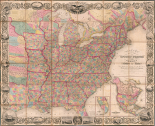
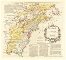
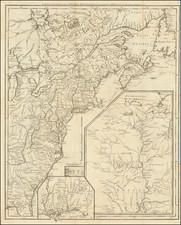
Interesting set of 5 maps, showinghte growth of the United States through 1853.
The first map shows the population enters in in the US at the time of the American Revolution.
The second map references the "intellectual culture."
The third and fourth maps show Free, White and Slave States in 1850.
The fifth map shows the Indian populations in1853.
August Heinrich Petermann (1822-1878) is a renowned German cartographer of the nineteenth century. Petermann studied cartography at the Geographical Art-School in Potsdam before traveling to Edinburgh to work with Dr. A. Keith Johnston on an English edition of Berghaus’ Physical Atlas. Two years later he moved to London, where he made maps and advised exploratory expeditions as they set off to explore the interior of Africa and the Arctic.
In 1854, Petermann returned to Germany to be Director of the Geographical Institute of Justus Perthes in Gotha. There, he was the editor of the Geographische Mittheilungen and Stieler’s Handatlas. The Royal Geographical Society of London awarded him their Gold Medal in 1860. He continued his interest in exploration in Germany, fundraising for the German Exploring Expeditions of 1868 and 1869-70, which sought an open Arctic sea. Tragically, he committed suicide in 1878.
![The Pathfinder Railway Guide Map. Western Section [Alaska, Yellowstone Park / Philippines / Hawaii / Guam]](https://storage.googleapis.com/raremaps/img/small/97894.jpg)