|
||

|

|
|

|
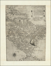
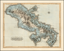
Rare separately issued map of Santa Domingo, with a 3 column note at the bottom of the map.
Map of the island of Hispaniola, or Saint Domingue, which contains present-day Haiti and the Domincan Republic. Cartographic elements include some topographical detail, sea banks, scales, and location of roads and boundary between Spanish and French Hispaniola. Includes a ship and parts of Cuba and Puerto Rico. Text at bottom describes physical and political conditions of the island.
The Dutch cartographer, P. L. Griwtonn, included a detailed description of the Spanish and French portions of Hispaniola, a division formalized by the Treaty of Ryswick in 1697.
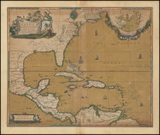
Jean Lattré (fl. 1743-1793) was a Parisian bookseller and engraver who published many maps, plans, globes, and atlases. He worked closely with other important French cartographers, including Janvier, Bonne, and Delamarche, as well as other European mapmakers, such as William Faden, Santini, and Zannoni. Lattré is also interesting due to his propensity to bring suits against those who copied his work; plagiarism was common practice in eighteenth-century cartography and mapmakers struggled to maintain proprietary maps and information.