|
||

|

|
|

|
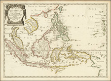
Detailed map of Southeast Asia from the Bay of Bengal to the Gulf of Tonkin and extending south to Singapore and part of Sumatra.
Indicates place names, topography and waterways (presumed rivers are represented with dotted lines). Includes some navigational notes. British territory is indicated with red.
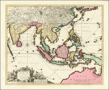
'The Weekly Dispatch' newspaper between the years 1856 and 1862 included in each edition a map of a part of the world. During this period a total of 118 maps were issued. The maps bear the distinctive sign of a half globe with the figure of Mercury above. The engravers varied but included John Dower and Edward Weller.
In 1863 'The Dispatch Atlas' was published which contained a series of English county maps. The two were combined in 1865 as 'Cassell's Complete Atlas'. With many maps in a large scale of areas not often seen, including a number a town plans.