


|
||

|

|
|

|
Extremely rare arge format map of Central America, prepared during one of the most fascinating periods in American History, during whch time a number of Foreign and Domestic powers fought and schemed for control of the region.
Kiepert's map was one of the most detailed and important maps of Central America of the period and appears in several major National Library collections, but is otherwise very rare, this being the first example we have ever seen on the market. The present example of the map was apparently utilized by a contemporary owner to track the various French, English and American proposals for canals crossing Central America.
The map includes inset maps showing the State of San Salvador and the Proposed Honduras Railroad; The Isthums and Raiload of Panama ad surveyed by G.W. Hughes; The River San Juan De Nicaragua as surveyed by von Bulow; the Isthums of Tehuantepec as surveyed by Barnard; and the Tract of the Canal of the Rio Atrato as surveyed in 1854 by W. Kennish of New York.
The annotations on this map are relatively confusing, but suggest knowledge of various proposals for constructing canals across Central America, including Pr. Napoleon, Pr. Belly, Pr. Garella, Pr. Darien and Pr. Anlgai?
Pr. Napoleon would refer to the proposal favored by Napoleon III to construct a crossing through Nicaragua. During this time, Napoleon III and Maximillian were actively proposing a Central American Alliance to control commerce and transit across the Isthmus and to block American private and commercial efforts to control the region. Napoleon III was known to favor a series of canals through Lake Nicaragua.
Pr. Belly refers to Felix Belly, who pursued an canal project and French Colony in Central America during this period. In 1858, Belly secured for his firm, Belly, Milaud, et Compagnie, a contract from Nicaragua for a canal along the Sapoa River to Salinas Bay, a route which had been recommended to Costa Rica by Orsted in 1848. The Nicaraguan government cancelled the contract in 1868 and transferred it to Michel Chevalier, another Frenchman, who had for some years previously been prospecting in Central America on behalf of the Emperor Napoleon. Chevalier insisted, as an essential preliminary, that the contract should be ratified by the congress of Costa Rica, through a portion of whose territory the canal was to run. This ratification was granted, but not until 1869, and before anything was done to construct the canal, the great Franco-Prussian War of 1870-1871 broke out, and the downfall of the empire and the chaos which that event engendered in France swamped all Chevalier's hopes of success in financing his concession.
Pr. Garella references Napoleon Garella, an engineer sent to Panama by the French government from 1838 to 1843, to study and report on the prospects for crossing Central America by Canal. Garella recommended a canal from Limon Bay to the bay of Boca del Monte, twelve miles west of Panama; but want of capital caused this canal project, as well as the other projects envisaged by the concession, to be abandoned.
Pr. Darien refers to an English and America Proposal for a canal and colony, led by Sir Charles Fox, John Henderson, Esq., Thomas Brassey, Esq., and Dr. Edward Cullen. The Government of the Republic of New Granada provided a concession in 1852 to cut a Ship Canal across the Isthmus of Darien, between the Gulf of San Miguel on the Pacific, and the Bay of Caledonia on the Atlantic, and the right to select any other point on the Atlantic coast between Punta de Mosquitos and the west mouth of the Atrato, for the entrance of the Canal. The Governments of Great Britain and the United States, in accordance with the provisions of the Bulwer and Clayton Treaty, signed at Washington, April 19th, 1850, were to provide protection to any Company undertaking the construction of the canal.
Geographer Heinrich Kiepert (1818-1899) is generally reckoned one of the more important scholarly cartographers of the second half of the 19th century. Kiepert's maps are almost invariably clear and easy to read, and they are as accurate as the scholarship of the day permitted.
![[ Aztec Plan of Mexico City ] Facsimile of Page 1 of the Mendoza Collection of Mexican Picture paintings... | Mendoza Col Selden MSS. 3134.](https://storage.googleapis.com/raremaps/img/small/102305.jpg)
![[Sketch of Río Chacalapa and surrounding hills]](https://storage.googleapis.com/raremaps/img/small/49303ba.jpg)
![[ Yucatan ] Karte der Halbinsel Yucatan, hauptsächlich nach der von Joachim Hubbe und Andres Aznar Perez zusammengestellten und von C. Hermann Berendt revidirten und vermehtren Mapa de la Peninsula de Yucatan von 1878](https://storage.googleapis.com/raremaps/img/small/96420.jpg)
![(Mexican-Aztec Painting) [Watercolor of three Aztec deities from the Codex Vaticanus:] Toxcatl, God of Droughts and Inundations. Cod. Vat. Tlaloc. God of Water. Cod. Vat. Tecuilvitontl [Tecuilhuitontli] The Lesser Festival of the Lords. Cod. Vat.](https://storage.googleapis.com/raremaps/img/small/103009.jpg)
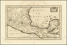
![Culiacanae, Americae Regionis, Descriptio [with] Hispaniolae, Cubae, Aliarumqe Insualrum Circumiacientium Delineatio](https://storage.googleapis.com/raremaps/img/small/86114.jpg)