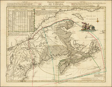
|
||

|

|
|

|
Rare map of the East Coast of North America, with a marvelous large format map of the region b etween Cape Henry and Long Island. The map appeared in the Atlas Maritimus et Commercialis, published in London in 1728 as a competitor to the English Pilot. Such famous names and Edmund Halley and Daniel Defoe contributed to the publication, along with John Senex. The large format inset of the Chespeake region is of particular note, being one of the largest format and most detailed chartings of the region to date. Over 100 place names are shown, along with soundings, shoals, etc. New Jarsey and East New Jarsey are named, as are Bergen County, Essex County, Middlesex and others. Includes excellent detail around NYC. An inceasingly rare map, which is seldom seen on the market, and often in much poorer condition. An terrific early English Colonial American map. McCorkle 728.2.
Edmund Halley (ca. 1656-1742) was one of Britain’s foremost astronomers and natural philosophers. He was also an explorer and mapmaker famous for his voyages to study magnetic variation. Edmund was born in Shoreditch, London. After the Great Fire of 1666, his family moved to Winchester Street, near where the Royal Society, one of the world’s first scientific societies, then had its rooms.
Halley began his astronomical observations as a schoolboy at St. Paul’s School and later at Queen’s College, Oxford. By the time he left Oxford, he had already written three scientific papers and was in touch with the foremost minds in Europe, including the architect Christopher Wren, the natural philosopher Robert Hooke, and fellow astronomers, John Flamsteed, Jean Dominique Cassini, and Johann Hevelius.
Halley left Oxford without a degree because he wanted to travel to St. Helena to determine the positions of the southern stars and to observe the Transit of Mercury, a project he embarked on with the support of Charles II and the East India Company. Although not entirely successful, the star chart he published as a result earned him Fellowship in the Royal Society. In 1680, Halley and a school friend embarked on a scientific Grand Tour of Europe, observing, en route, the first appearance of a bright comet.
He discussed this comet with Isaac Newton upon his return. Halley struck up a great friendship with Newton and oversaw the publication of Newton’s masterpiece, Philosphiae naturalis principia mathematica (1687). Halley wrote the Latin preface to the work, the most important in the field of physics ever published.
In the 1680s, Halley became interested in magnetic variation. As part of these studies, he produced one of his first known maps, a chart of the trade winds, the first such meteorological chart of its kind. To gather more data on the worldwide phenomena, Halley gathered information about winds and magnetic variation from a global network and took to the sea himself to make surveys and observations. In 1689 he presented a chart of the Thames approaches to the Royal Society. In 1691, he improved the design of a diving bell to help with the salvage of a cargo of gold and ivory.
Halley’s interest in sailing and charting continued in the 1690s, even as he worked as warden to the country mint at Chester. He published a flurry of scientific papers in this decade on topics including life expectancy, optics, rainbows, thermometers, and barometers. Most influential of his work for this time, he calculated the orbit of 24 comets and concluded that comets like the one he saw while on the Grand Tour have elliptical orbits. He also explained that the comet of 1682 had a return period of roughly 75 years; this comet was later named for Halley.
In 1698, Halley was given command of the purpose-built Royal Naval ship the Paramore. He set sail for the South Atlantic to make observations of magnetic variation. He embarked on a second cruise in 1699, also to the South Atlantic. These two voyages served as the basis for a chart of magnetic variation that covered the entire Atlantic, the first surviving chart to use isogonic lines and one of the first thematic charts ever produced. In 1701, Halley took the Paramore on a final cruise in the English Channel, which resulted in another chart that was a vast improvement on previous Channel charts.
Upon outbreak of the War of Spanish Succession, Halley was charged with surveying on behalf of England, a role which took him to the Adriatic. After completing his work there, he returned to an appointment as Savilian Professor of Geometry at Oxford. One of his major projects while there was to publish Flamsteed’s star charts, a project which contributed to the already stormy relationship between the men. In 1715, Halley drew a map of totality for a rare solar eclipse that would pass through London; his observations were still being used by astronomers in the twentieth century. In 1721, he succeeded Flamsteed as the second Astronomer Royal and moved to Greenwich, where he was concerned with the saronic cycle of the moon and, as ever, comets. He died there in 1742.

![[French Colonization in Florida and the Southeast] La Floride Francoise Dressee sur La Relation des Voiages que Ribaut, Laudonier, et Gourgues y ont faits in 1562, 1564 et 1567 . . .](https://storage.googleapis.com/raremaps/img/small/91072.jpg)

![A New Map of Virginia [Chesapeake]](https://storage.googleapis.com/raremaps/img/small/43053.jpg)