


|
||

|

|
|

|
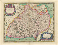
A large format regional map from and Italian edition of Ptolemy, printed by Nicolo Todescho in Florence. This edition is noteworthy for including the first 3 modern maps to be included in a Geographia. The Florence edition is attributed by Nordenskold as published in 1478, is one of the earliest and rarest of early printed maps. Coming only a few decades after Gutenberg's first printed work. This map is not reported in any edition of Jolly. Printed on two sheets. Minor repairs where the sheets are joined and at the margins. Still an excellent cartographic incunable.
Francesco Berlinghieri (1440-1501) was a Florentine engraver. Nicolas Laurentii published Berlinghieri's edition of Ptolemy, which was written in Italian terza rima, comprising 123 folios of text and 31 engraved maps. The work was first printed in 1482, but most surviving examples come from the edition of 1486, which was the first edition to include red printing in the title page. The full title is Geographia. In Questo Volume Si Congengono Septe Giornate Della Geographia Di Francesco Berlingeri Fiorentino Allo Illustrissimo Federigo Duca . . .
Berlinghieri's edition of Ptolemy is unique, in that it includes 31 maps covering Europe, northern Africa and the south part of Asia and is the first atlas to attempt the introduction of modern geography, with the inclusion of four new maps - France, Italy, Spain and Palestine, which are based on contemporary knowledge. rather than a strict plotting of Ptolemy's coordinates. A number of other maps in the Berlinghieri edition of Ptolemy include data which is drawn from modern sources, albeit more subtlely so, in part because of transcription errors and in part because of corrections made over time by later scholars.
While Berlinghieri's atlas was the third Italian printed edition of Ptolemy, it was very important in other respects. Berlinghieri's Ptolemaic regional maps are drawn on Marinus' plane projection; and although not generally considered an edition of Ptolemy, the maps are the only examples of Ptolemy's maps to be drawn on the original projection, with equidistant meridians and parallels. Berlinghieri's work was also the first to include a printed Gazetteer for each of the maps.
The text by Berlingheiri is a metrical paraphrase of Ptolemy, the first atlas in the Italian language. Francesco Berlinghieri was an Italian scholar and humanisrt. He promoted the value of classical Greek learning and therefore was the first to print an edition of Ptolemy in vernacular Italian, rather than Latin. The maps look distorted as compared to modern maps, because Ptolemy's data was inaccurate. One reason is that Ptolemy estimated the size of the Earth as too small: while Eratosthenes of Cyrene, a Greek mathematician, elegiac poet, athlete, geographer, and astronomer, made several discoveries and inventions including a system of latitude and longitude and conceived the idea of 700 stadia for a degree on the globe, in the Geographia Ptolemy uses 500 stadia. It is not certain if these geographers used the same stadion, but if we assume that they both stuck to the traditional Attic stadion of about 185 meters, then the older estimate is 1/6 too large, and Ptolemy's value is 1/6 too small. Because Ptolemy derived most of his topographic coordinates by converting measured distances to angles, his maps get distorted. So his values for the latitude were in error by up to 2 degrees. For longitude this was even worse, because there was no reliable method to determine geographic longitude.
Ptolemy was well aware of this. It must be added that his original topographic list cannot be reconstructed: the long tables with numbers were transmitted to posterity through copies containing many scribal errors, and people have always been adding or improving the topographic data: this is a testimony to the persistent popularity of this influential work in the history of cartography..
As early as 1938 Arthur M. Hind, Keeper of Prints and Drawings at the British Museum, hinted that the engravings might have been made by Francesco Rosselli (1448-before 1527), the principal engraver in Florence in the 1480s and 1490s. Subsequently, this possibility was rejected by Roberto Almagiagrave, R. A. Skelton and Tony Campbell. In the author's view, however, both stylistic and circumstantial evidence argues that Francesco was indeed the engraver, and that this first major commission launched the career that eventually made him known to his contemporaries as 'Franciscus rosellus florentinus Cosmographus'.

![[First Postwar Elections In West Germany] Elections Au Bundestage du 14 Aout 1949](https://storage.googleapis.com/raremaps/img/small/78827.jpg)