
This item has been sold, but you can enter your email address to be notified if another example becomes available.


|
||

|

|
|

|
Stock# 2708
Description
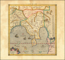
Detailed map of Indian from Cabul, the Indus River and Arabian Sea to Ceylon and the Maldives, the Bay of Bengal, Bootan and Assam, and on to Thibet and the headwaters of the Ganges. A key identifies the various regional powers and territories. Detail includes provinces, cities, towns, rivers, moutnain, deserts, islands, etc. Cleanly repaired tear, else a nice example. Robert Wilkinson was active in London as a cartographic publisher from 1785 to 1825. He produced a number of nice works, including a General Atlas and a re-issuance of Bowen & Kitchen's English Atlas, along with excellent large format separate maps.
![[ Hooghly River ] Carte Des Entrees De La Riviere D'Hoogly depuis la Fausse Pointe Palmiras jusqu'a la Rade de Saguor Levee in 1817 Par le Capitaine Wm. Maxfield . . . . / Carte Des Entrees De La Riviere D'Hoogly depuis l'Ile Saguor jusqu'a Dressee . . . la Compagnie Anglaise des Indes Orientales . . . 1838](https://storage.googleapis.com/raremaps/img/small/57779.jpg)
![[ Bombay ] Plan du Port de Bombay situe par 19 deg. de Lattit. Nord et par 70 deg. 41 min de Longit du Meridien de Paris](https://storage.googleapis.com/raremaps/img/small/95158.jpg)
![[India] Tab. X. Asiae Complectens India intra Gangem](https://storage.googleapis.com/raremaps/img/small/78289.jpg)
![[Pakistan & India] Tabula Asiae IX](https://storage.googleapis.com/raremaps/img/small/94368.jpg)
![Hindoostan. [with] Delta of the Ganges.](https://storage.googleapis.com/raremaps/img/small/80783.jpg)