This item has been sold, but you can enter your email address to be notified if another example becomes available.


|
||

|

|
|

|
Stock# 26593
Description
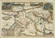
Decorative 18th Century map of the Arabian Peninsula, published in Rome by Cassini.
The map extends from the Red Sea to hte Persian Gulf, Straits of Hormuz and Indian Ocean, centered on Arabia, which is divided into several regions, including Paese di Nagen, Paese Di Mahre, Seger, Yemen, Bahrein, and Teham. Dozens of early place names are shown.
Marvelous cartouche shows a nomadic camp ground, with indigenous animals and costumes.
![Persia [shows Armenia]](https://storage.googleapis.com/raremaps/img/small/72526.jpg)
![(World War II - Free French Forces Mapping) Beyrouth Ville [Beirut City] [on verso:] Lattaquié [Latakia]](https://storage.googleapis.com/raremaps/img/small/88805.jpg)