


|
||

|

|
|

|
One sheet of Nicolosi's important four sheet map of North America, published at the behest of the Vatican as a means of demonstrating Rome's involvement in modern cartography.
The present example is from the second edition of Nicolosi's 4 sheet map, graphically depicting the dramatic change in the 11 years since the publication of the first edition of 1660 and most notably the dramatic rise in English Colonial settlements and claims British Colonies. The first edition of the map can be seen at /gallery/detail/20480
This second edition includes significant revisions to the original map, including a greatly expanded list of place names along the Eastern Seaboard, with dozens of placenames added for the first time, including Long Island, Malabarre (Georges Shoal & Bank), Cape Hinelopen, Cape May, Cape Fear, Port Royal, Cape Canaveral, Tegesta, Tampa Bay, and dozens of new place names on the coat and interior of North America and the Caribbean.
There are also significant changes made in the map. A large group of islands to the east of Puerto Rico (Las Virgines) has been added. The 1671 edition of the map shows the boundary line depicting the Lord Proprietor's Grant of 1663 creating the Province of Carolina, along with a range of mountains dividing the Province of Carolina from the Virginia Colony to the North and from Florida in the west, along with a number of new place names in the region.
In the north, Lake Erie is now named and a number of Indian Tribes are shown in the interior, and Lake Ontario (L. de S. Louys) is shown. N. Suecia, the failed Swedish Colony on the Delware River appears, along with a new boundary between New Amsterdam and Virginia, which would appear to be the recently created New Jersey Colony.
Nicolosi based his 4 sheet map on Sanson's map of 1650, with several notable changes. For example, the Great Lakes are based upon Sanson's map, as is much of the nomenclature along the East Coast. Various Spanish, French, English and Dutch settlements are noted, including Bristow, Orange, Plimou[th], New Amsterdam, Jamestown, S. Matteo and S. Augustine and Richelieu. The name Costa d. Canibali is shown prominently to the east of the Windward Islands.
In 1652, motivated by Sanson's new work, the Propoganda Fide of Rome hired G.B. Nicolosi, who in turn published his Dell' Hercole e Studio Geografico, published in 1660 and 1671, which included dramatic 4 sheet maps of each of the continents, which incorporate Nicolosi's meticulous work with a quite unusual presentation style.
Giovanni Battista Nicolosi (1610-1670), also known as Giovan Battista, was a Sicilian priest, geographer and cartographer, who worked for the Vatican's Congregation for the Evangelization of Peoples (or Propaganda Fide) under Pope Gregory XV. Officially, the Fide office was established to promote missionary work across the globe, but the reality was that it constituted an important office for the maintenance and dilation of the Church’s power in an ever-expanding world.
Arriving in the papal capital around 1640, Nicolosi devoted himself to the study of letters, sciences, geography and languages. In 1642, he published his Theory of the Terrestrial Globe, a small treatise on mathematical geography, and, a few years later, his guide to geographic study, which was a short treatise on cosmography and cartography. Both works reflected a Ptolemaic world view, but his guide to geographic study would soon serve as an introduction to Nicolosi’s real magnum opus, Dell' Ercole e Studio Geografico, which was first published in 1660. His Theory of the Terrestrial Globe, on the other hand, brought Nicolosi to the attention of broader scientific circles and earned him the Chair in Geography at the University of Rome.
In late 1645, Nicolosi travelled to Germany at the invitation of Ferdinand Maximilian of Baden-Baden, where he remained for several years until returning to Rome. Here, Nicolosi was appointed chaplain of the Borghesiana in the Basilica of Santa Maria Maggiore. This honor was conferred on him by Prince Giovanni Battista Borghese, who Nicolosi himself had tutored and in whose palace he had lived since 1651. Years later, Nicolosi would thank the prince for his generosity by dedicating his most seminal work to him.
One of Nicolosi's most significant contributions to the history of science and geography is the so-called map of the world on a globular projection. First published in 1660, Nicolosi's map of the world, produced ny the Vatican, constituted a pioneering innovation in the way in which the physical world was portrayed. This entirely new perspective on geography was groundbreaking and quickly adapted across the cartographic plane. It has consequently come to be known as the ‘Nicolosi projection’. In truth, Nicolosi's globular projection is a polyconic map projection invented by Abū Rayḥān Muḥammad ibn Aḥmad Al-Bīrūnī, the foremost Muslim scholar of the Islamic Golden Age, who invented the first recorded globular projection for use in celestial maps about the year 1000 CE. Nicolosi was almost certainly not awared of the work of Al-Bīrūnī, and Nicolosi's name it typically attributed to the projection.
There exists in the Vatican and other National archives a considerable collection of Nicolosi’s unpublished work. This includes a large chorographic (i.e. descriptive) map of all of Christendom, commissioned by Pope Alexander VII, as well as a full geographic description and map of the Kingdom of Naples, which was sent to Habsburg Emperor Leopold I in 1654.

![A New Mapp of America Septentrionale . . . 1669 [California shown as an island]](https://storage.googleapis.com/raremaps/img/small/94304.jpg)
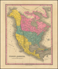
![[Educational Map] North America](https://storage.googleapis.com/raremaps/img/small/68773.jpg)