


|
||

|

|
|

|
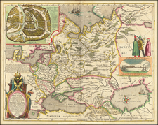
Detailed plan of San Juan Harbor in Puerto Rico, which appeared in Tirion's Hedendaagsch Historie of Tegenwordige Staat van Amerika.
The map includes a detailed plan of the fortifications of the Castillo Del Moro and Castilla de la Perla, along iwth showing hte road to Fort San Antonio and beyond. The harbor shows extensive soundings and includes seveal additional placenames, including Boca de Congrejos, Punta San Juso, Unta De San Juan, Punta St. Jago, Punta de la Savana, el Canuel, Rio de Palo Seco and Ysla de Cabras.
Isaak Tirion was a prominent Dutch publisher based in Amsterdam in the eighteenth century. He is best known for historical works that included prints showing scenes from around the world. He also produced maps, such as those in the Nieuwe Hand-Atlas of 1744.

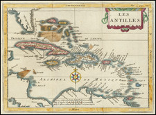
![[Martinique, Guadaloupe, Dominica and Marie Galante] . Suite des Isles Antilles 2. Partie](https://storage.googleapis.com/raremaps/img/small/81614.jpg)

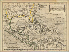
![The West India Islands, and Central America [with] Jamaica](https://storage.googleapis.com/raremaps/img/small/78675.jpg)