|
||

|

|
|

|
Exceptionally rare map of Maryland, Virginia, Delaware & the Chesapeake Region, from one of the most sought after early 19th Century American Cartographers.
Several early railroads shown in red, including the route from Richmond to Fredericksburg, several lines out of Philadelphiaand Baltimore, and other lines reaching Winchester, Virginia and Washington D.C. Canals, Turnpikes, Main Roads and Common Roads also noted, along with distances. A table of distances from Baltimore to various cities is shown at the top and left.
Bound into the folder is a contemporary manuscript map centered on the James River, Natural Bridges and the Cow Pasture River, showing details of the Hot Srings area of Virgina, bounded by Blue Sulphur Springs, Staunton, Lexington, Amsterdam, and Red Sulpher Springs, and showing the roads and distances between a number of locations.
Fielding Lucas Jr. was most active prior to 1825. He published his New & Elegant Atlas and contributed to the maps of Carey & Lea. However, very few separately issued maps by Lucas were issued and most are very rare, especially those issued after 1830.
Only one appearance in a dealer catalogue in the past 25 years (High Ridge, 1989). We previously offered an example in 2006.
Fielding Lucas, Jr. (1781-1854) was a prominent American cartographer, engraver, artist, and public figure during the first half of the 19th century.
Lucas was born in Fredericksburg, Virginia and moved to Philadelphia as a teenager, before settling in Baltimore. There he launched a successful cartographic career. Lucas's first atlas was announced in early- to mid-1812, with production taking place between September 1812 and December of 1813, by which point the engravings were complete. Bound copies of the atlas -- A new and elegant general atlas: Containing maps of each of the United States -- were available early in the next year, beating Carey to market by about two months. Lucas later published A General Atlas Containing Distinct Maps Of all the known Countries in the World in the early 1820s.
![(18th-Century Southern Borderlands) [Collection of manuscript letters to Secretary of War James McHenry from confidential U.S. agent John McKee, relating to southern borderlands, Native Americans and Panton, Leslie & Co.; a letter from John McKee written from Mobile, Alabama, to William Blount of Blount's Conspiracy fame; a letter from William Panton concerning John McKee; and letters from Felix D. St. Hilaire, concerning General Victor Collot]](https://storage.googleapis.com/raremaps/img/small/90005.jpg)
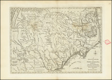
![[North Carolina]. Carte Geographique, Statistique Et Historique De La Caroline Du Nord](https://storage.googleapis.com/raremaps/img/small/57603.jpg)