|
||

|

|
|

|
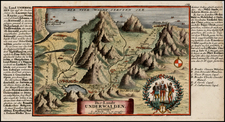
Rare Dezauche edition of Le Pere Placide de Sainte Helene's map of the Savoy region.
The map extends from Grenoble and Geneva in the west to the Canton of Berne and Piemonte. Includes a decorative globe atop the cartouche. Includes marvelous detail in this region of the southwestern Alps.
We were able to locate a map of a similar title by Dezauche in an atlas of maps between 1784 and 1794, but the map is apparently quite scarce on the market.
Jean-Claude Dezauche (fl. 1780-1838) was a French map publisher. Initially, his work focused on engraving music, but he later turned primarily to cartography. His is best known for editing and reissuing the maps of Guilluame De L’Isle and Philippe Buache, two of the most skilled mapmakers of the eighteenth century. He acquired the plates of these two men’s work in 1780 from Buache’s heir, Jean-Nicolas Buache. Dezauche's business received a further boon when he received a privilege to sell the charts of the Dépôt de la Marine. His business was carried on by his son, Jean-Andre Dezauche.
![(Second World War - Prelude to War) Die Luftbedrohung Deutschlands [The Air Threat to Germany]](https://storage.googleapis.com/raremaps/img/small/84075.jpg)