


|
||

|

|
|

|
In December 2000, Sotheby's offered a map which would appear to be a Faden edition of this map, dated 1820 and described as follows:
North America-Faden, W. Map of North America from 20 degrees to 80 degrees north latitude exhibiting the recent discoveries, geographical and nautical. London: Willam Faden, 1820
Total dimensions if joined 1480 x 1650mm., large engraved wall-map in 6 sheets, original outline colour . . .
Extremely detailed map of North America, incorporating the discoveries of explorers such as Pike, Humboldt, Lewis and Clark, Mackenzie, Ross and Vancouver. Within Arctic Canada are pencil additions, supplying a northern coast for Alaska and additional information for the region between Baffin's Bay and Hudson's Bay, the latter additions in German.
Full Title: Map of North America Exhibiting The recent Discoveries, Geographical and Nautical; Drawn Chiefly from the Authorities of M. De. Humboldt, Lieutt. Pike, Messrs. Lewis and Clarke, Sir. Alexandr. MacKenzie, Mr. Hearne, Coll. Bouchette, Captns, Vancouver, Ross, Parry, Franklin & Back, also describing the Boundary Lines between the Territories of Great Britain, the United States, and the Mexican and Central States -- London Published forJa. Wyld, successor to W. Faden. No. 5 Charring Cross. Geographer to Her Majesty. 1838
James Wyld Sr. (1790-1836) was a British cartographer and one of Europe’s leading mapmakers. He made many contributions to cartography, including the introduction of lithography into map printing in 1812.
William Faden, another celebrated cartographer, passed down his mapmaking business to Wyld in 1823. The quality and quantity of Faden’s maps, combined with Wyld’s considerable skill, brought Wyld great prestige.
Wyld was named geographer to Kings George IV and William IV, as well as HRH the Duke of York. In 1825, he was elected an Associate of the Institution of Civil Engineers. He was one of the founding members of the Royal Geographical Society in 1830. Also in 1830, his son, James Wyld Jr., took over his publishing house. Wyld Sr. died of overwork on October 14, 1836.
James Wyld Jr. (1812-87) was a renowned cartographer in his own right and he successfully carried on his father’s business. He gained the title of Geographer to the Queen and H.R.H. Prince Albert. Punch (1850) described him in humorous cartographic terms, “If Mr. Wyld’s brain should be ever discovered (we will be bound he has a Map of it inside his hat), we should like to have a peep at it, for we have a suspicion that the two hemispheres must be printed, varnished, and glazed, exactly like a pair of globes.”
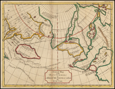
![[Alaska, Northwest Coast and North Pacific Ocean] Der Noerdliche Theil des Grossenwelt Meeres . . . 1804](https://storage.googleapis.com/raremaps/img/small/80463.jpg)