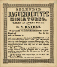
|
||

|

|
|

|
Striking allegorical title page, from Volume 2 of Braun & Hogenberg's Civitatus Orbis Terrarum.
Designed as a companion to Ortelius' world atlas, Braun & Hogenberg's remarkable set of city plans andtowns views ultimately grew to six volumes by 1617, including over 500 city plans and views. It was one of the most important and lavinsh publications ever undertaken and among the greatest achievements in the history of cartography. The Civitates was the world's first systematic city atlas. Its chief author was Georg Braun, canon of Cologne Cathedral, who gathered information from travellers, geographers and scholars throughout Europe and beyond. Franz Hogenberg, a friend and colleague of Mercator and Ortelius, was the main engraver, later succeeded by his son Abraham.
This titlepage is a fine example of cartographic illustration. At the top are figures representing Religion and Politics, placed on either side of Cybele, who is seated on a chariot drawn by lions. At the bottom of the stone entablature are the household gods Penates and Lares.
Georg Braun (1541-1622) was born and died in Cologne. His primary vocation was as Catholic cleric; he spent thirty-seven years as canon and dean at the church St. Maria ad Gradus, in Cologne. Braun was the chief editor of the Civitates orbis terrarum, the greatest book of town views ever published. His job entailed hiring artists, acquiring source material for the maps and views, and writing the text. In this role, he was assisted by Abraham Ortelius. Braun lived into his 80s, and he was the only member of the original team to witness the publication of the sixth volume in 1617.
Frans Hogenberg (ca. 1540-ca. 1590) was a Flemish and German engraver and mapmaker who also painted. He was born in Mechelen, south of Antwerp, the son of wood engraver and etcher Nicolas Hogenberg. Together with his father, brother (Remigius), uncle, and cousins, Frans was one member of a prominent artistic family in the Netherlands.
During the 1550s, Frans worked in Antwerp with the famous mapmaker Abraham Ortelius. There, he engraved the maps for Ortelius’ groundbreaking first atlas, published in Antwerp in 1570, along with Johannes van Deotecum and Ambrosius and Ferdinand Arsenius. It is suspected he engraved the title page as well. Later, Ortelius supported Hogenberg with information for a different project, the Civitates orbis terrarium (edited by Georg Braun, engraved by Hogenberg, published in six volumes, Cologne, 1572-1617). Hogenberg engraved the majority of the work’s 546 prospects and views.
It is possible that Frans spent some time in England while fleeing from religious persecution, but he was living and working in Cologne by 1580. That is the city where he died around 1590. In addition to his maps, he is known for his historical allegories and portraits. His brother, Remigius, also went on to some fame as an engraver, and he died around the same time as his brother.
![(Wine) La Ste Bouteille [The Holy Bottle]](https://storage.googleapis.com/raremaps/img/small/101231.jpg)
![(Smut Broadside) Leonard Smith's Patent Improved Ventilating Smut Machine [caption title].](https://storage.googleapis.com/raremaps/img/small/91490.jpg)
![(The First Letter From British Florida) [September 5, 1763, Autograph Letter, Signed, from Robert Campbell to John Campbell, 4th Earl of Loudoun, describing the British taking possession of Florida and the state of the settlement of Pensacola]](https://storage.googleapis.com/raremaps/img/small/86620.jpg)
![[Manuscript Title Page and Table of Contents for a large Composite Atlas with maps by De L'Isle, De Fer, Le Rouge, Nolin, Bellin and others]](https://storage.googleapis.com/raremaps/img/small/88241.jpg)