


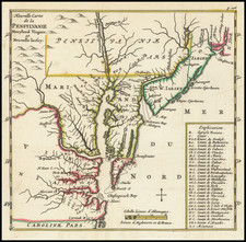
|
||

|

|
|

|
Rare souvenir edition Hill's Plan of Washington, printed in red on linen.
Hill's Plan of Washington is the earliest official map of the City of Washington, pre-dated only by the pirated miniature magazine edition of the Hill and the pirated miniature magazine edition of the Thackara. On January 24, 1791, President George Washington announced the permanent location of the national capital, a diamond-shaped ten-mile tract at the confluence of the Potomac and Eastern Branch Rivers.
The original survey was performed by Andrew Ellicott and Benjamin Bannaker (a freed slave). In March of 1791, Major Pierre Charles L'Enfant was appointed by Washington to prepare the plan for the city with Ellicott as his assistant.L'Enfant turned out to be difficult to work with and Thomas Jefferson and Washington ultimately suspended L'Enfant in 1792. Ellicott took over the project using L'Enfants plan as a base.
Philadelphia engravers James Thackera & John Vallance and Samuel Blodget Jr. were hired to produce engraved versions of th L'Enfant/Ellicott Plan. Blodget arranged for Samuel Hill of Boston to engrave the map for him. Both Hill and Thackera & Vallance produced a large official map of the new Federal City (along with minature editions, which appeared in magazines). The official version was issued in September 1792, pre-dating the Philadelphia edition by several months.
In 1792, a souvenir edition of the map, also printed in red on linen, also appeared on the market. the attribution to I.L. Philips & Brothers is based upon OCLC entries for examples of the map at the Library of Congress and District of Columbia Public Library. OCLC lists a total of 3 examples, the other being at the NY Publlc Library.
![[ New York Harbor ] Entree de la Riviere D'Hudson depuis la Pointe Sandy Hook jusqu'a New York les Bancs, les Sondes les Guides &c. . . 1778](https://storage.googleapis.com/raremaps/img/small/78970.jpg)

![A Geographical Chart: or, A Scheme, Comprehending The Most Important Particulars Relative To The Geography of North and South-America. : Designed to be an Auxiliary to the Student. Carefully Compiled from the Best authorities, by Amos Bingham [Copy-Right Secured]](https://storage.googleapis.com/raremaps/img/small/41406.jpg)
![Vereinigte Staaten Von Nordamerika [United States of America]](https://storage.googleapis.com/raremaps/img/small/79951.jpg)