|
||

|

|
|

|
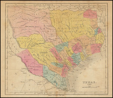
Rare early map of Callahan County, Texas, published for the Texas & Pacific Railway Company.
The map covers the area just east of Abilene, Texas, including the towns of Clyde and Baird in the lands listed as Buffalo Bayou Brazos & Colorado Railroad Company lands and the towns of Bremen (now Putnam) and Delmar (as Texas & Pacific Railway station which existed for only 2 years). The Handbook of Texas on Line notes as follows:
DOTHAN, TEXAS. Dothan, near the Callahan county line seven miles west of Cisco in northwestern Eastland County, is on the former site of a depot established as Delmar when the Texas and Pacific Railway built through the area in 1880. Within a year or two, Delmar apparently ceased to exist, as the focus of local rail activity shifted to Red Gap and then to Cisco in 1882. A new community named Dothan sprang up at the site and gained a post office in 1902. A school was established soon afterward, and by 1915 Dothan reported a population of fifty. The community's school was closed in 1940, by which time the population had declined to twenty, a level it still retained in 1990 and 2000.
BIBLIOGRAPHY: Homer Stephen, The Frontier Postmasters (Dublin, Texas: Dublin Progress, 1952).
The map shows the remaining unsold lands owned by the Texas & Pacific Railway Company, along with lands owned by numerous other individuals, companies, municipal entities and other railroads, along with towns, townships, railroad lines, stations, roads, etc. Extensive manuscript notes.
![(Republic of Texas Land Grants with Maps - Coahuila y Tejas) [Manuscript land grant documents issued by Radford Berry, alcalde of Nacogdoches, to John Adams and others, with manuscript plat maps by Arthur Hendrie and George Aldrich]](https://storage.googleapis.com/raremaps/img/small/88920.jpg)