|
||

|

|
|

|
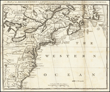
Wilkinson's 1804 map of North America is among the rarest and most interesting maps, including one of the earliest depictions of Louisiana Territory and a late depiction of the proposed State of Franklin.
Wilkinson's map (first issued in August 1804) is the first to show the entire Louisiana Territory as part of the United States, which is both shown on the map and in the table showing the possessions of the United States: "Province, Ceded by France 30 Apr. 1803, Louisiana." While Bradley's Map of The United States dated 2 June 1804 is the first map to mention the cession of Louisiana: "The French call the country West of Conecuh River Louisiana & have ceded it to the United States," the Bradley map shows only a small portion of Louisiana Territory just west of the Mississippi River.
Wilkinson's marvelously detailed ma follows Arrowsmith's Map Exhibiting all the New Discoveries in the Interior Parts of North America (1802) in the Rocky Mountain and the Oregon River areas, and adds new settlements and place names not on Arrowsmith's map along the northwest coast. Franklinia is shown between Tennessee and North Carolina.
Wheat notes that "New Albion covers the Great Basin and the Pacific Coast nort of California, but vies with 'quivira or Moosemlek [of Lahontan] Indians much civilized having 100 towns and sailing with large vessels. . . 'Pearl Shell Lake according to Lahonatan and from Indian reports salt water' is just across from the range from 'Gnacsitares' and "Essanapes,' and (on what is probably the Platte, but it may be the Kansas . . .) 'R. Morte ou R. Longue according to Lahontan.' Proceeding north, the Missouri is drawn according to the Blackfoot Chief of Fidler, but with the remark, "Northern Bend of the Missouri observed by Tompson 1798.' (Wheat 357).
The irony of Wheat's description is that Wheat, unaware of the rare first edition of 1804, was in fact describing the atavistic qualities of this second edition of the map, not realizing that he was in fact looking at a second edition of one of the most interesting and accurate large format maps of North America issued prior to the appearances of the maps of Humboldt, Lewis & Clark, Pike and Stephen Long. In fact, only Wilkinson's address and the year depicted in the title of the map have been changed from the original.
Overlooking the date on the map and looking to the details as depicted in the first edition, the map is without question and under-appreciated cartographic landmark, which was painstakingly compiled by Wilkinson. Other interesting notes include the location of Santa Fe based upon the Astronomical Observations given by Vancouver, the remarkable detail of the River systems shown by Wilkinson in the Transmississippi West (both actual and conjectural) and the numerous Indian Tribes depicted. But for the rarity of the map, it would unquestionably have received much greater attention among collectors and scholars. Until 2008 (Sothebys), no copy of the map had appeared at Auction since the Streeter Sale.
![The Mother Lode of California [Guide to the Mother Lode Mariposa to Downieville]](https://storage.googleapis.com/raremaps/img/small/97535.jpg)