|
||

|

|
|

|
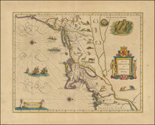
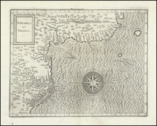
Fascinating map of Western Virginia, centered on the Ohio and the Patomak Rivers and showing a number western settlements in Virignia.
The map is drawn from the map of the Western part of Virginia which appeared in The Journal Of George Washington, Sent By The Hon. Robert Dinwiddie ... To The Commandant Of The French Forces On The Ohio . . . (London, 1754) and was one of the first American maps to appear in the London Magazine. The map accompanied an excerpt from George Washington's journal. Washington's route from Williamsburg to the French fort on Lake Erie is shown. A decorative cartouche portrays natives engaged in tobacco production. "Six Nations" appears just under Katarakui or Ontario Lake. Lake Erie is styled Lake Erri or Okswego. Niagra Falls is located with the notation "Niagra Cataract 137 feet." The Indian names of numerous settlements appear.