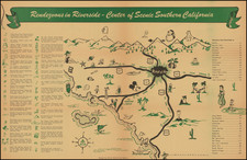
|
||

|

|
|

|
Fabulous early map of the Monterey Peninsula Country Club, shortly after its initial subdivision by the Del Monte Properties Company in 1919. The map shows the layout of the Golf Course (including little flags noting the location of the greens) and initial subdivisions, including the Club House and several other buildings on the Golf Course. At the north end, a massive area of Sand Dunes are noted. In the south, a Deserted Indian Village is shown. The 17 Mile Drive is prominently located, along with the other early roads and streets. Bird Rock and Seal Rock are named, along with Point Joe and Moss BEach.
Pebble Beach was an exclusive community originally created as the Del Monte Properties Company in 1919. This is one of the earliest obtainable maps of the Country Club.
![[Mexico and Central America with Baja California inset, from Generalkarte von Nord America samt den Westindischen Inseln Versasst von Herrn. Pownall . . . MDCCLXXXVIII]](https://storage.googleapis.com/raremaps/img/small/95064.jpg)
![[Sonoma] Hyde Ranch](https://storage.googleapis.com/raremaps/img/small/66631.jpg)
![[Mendocino County Homesteading] Map of Mendocino County, California](https://storage.googleapis.com/raremaps/img/small/92125.jpg)