|
||

|

|
|

|
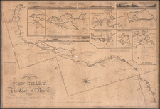
Rare separately issued chart of Santa Catalina Island and the neighboring coastline of Brazil. Includes a detailed key identifying 19 different points of interes, including Castles, beaches, islands, points, forts, etc. Shows soundings, anchorages, topography and other details. Very rare.
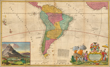
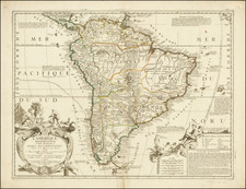
Tomás López de Vargas Machuca (1730-1802) was one of Spain’s most prominent cartographers in the eighteenth century. He was born in Toledo but studied at the Colegio Imperial in Madrid, where he focused on mathematics, grammar, and rhetoric. Along with a small group of colleagues, in 1752 the Spanish government sent López for training in Paris with the renowned geographer Jean Baptiste Bourguignon d’Anville. When he returned to Spain he was named Geógrafo de los dominios de Su Magestad and put in charge of the geographic collections of Charles III. He published many maps, including his fascinating maps of the Americas, and a variety of geography manuals. Some of his most famous maps are of the Iberian Peninsula, part of his large project to create a majestic atlas of Spain. Unfinished in his lifetime, López's children published the Atlas Geográfico de España (Geographical Atlas of Spain) in 1804. It was republished in 1810 and 1830.