
This item has been sold, but you can enter your email address to be notified if another example becomes available.


|
||

|

|
|

|
Stock# 1496
Description
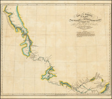
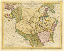
Fascinating pair of maps based upon the works of Kaempfer and Buache, illustrating two mid-18th Century projections of the NW Coast of America and NE Coast of Asia prior to Cook's first voyage. Buache's map is based largely upon Russian Sources derived from De L'Isle in Russia. Kaempfer's information was derived during his time in Asia. Many interesting and diameterically opposed cartographical myths are shown, including the Sea of the West, NW passage, various water routes across North America and unusual projections of Japan and the NE Coast of Asia. One of 10 maps in Diderot's treatise, which were generally focused on this region.
![The New Map and Street Directory of Shanghai City. Новый план города Шанхая с указателем улиц [Cover title] / The New Map and Street Directory of Shanghai City 最近實測上海地圖 [Zui jin shi ce Shanghai di tu]](https://storage.googleapis.com/raremaps/img/small/93141.jpg)
![[ Taiwan ] Die Insel Formosa neu abgemessen auf Befehl Kaysers Kamhi](https://storage.googleapis.com/raremaps/img/small/91214.jpg)