|
||

|

|
|

|
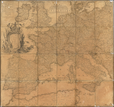
Decorative and highly detailed map of France, colored by provinces and showing towns, rivers, castles, lakes, mountains, etc. Scarce Ottens edition, based upon De Wit's map.
The Ottens brothers, Reiner and Joshua, operated a successful printing partnership in the mid-eighteenth century (fl. 1726-1765). They began the venture in 1726, publishing maps and other prints as “R & I Ottens.” They specialized in the reprinting of others’ work, especially Guillaume De L’Isle. In 1750, Reiner died; his soon, also Reiner, took his place, but the firm began listing their works as “Joshua & Reiner Ottens.” The firm lasted until Joshua’s death in 1765. Joshua’s widow, Johanna de Lindt, sold their remaining stock of plates in 1784.
De Wit (1629 ca.-1706) was a mapmaker and mapseller who was born in Gouda but who worked and died in Amsterdam. He moved to the city in 1648, where he opened a printing operation under the name of The Three Crabs; later, he changed the name of his shop to The White Chart. From the 1660s onward, he published atlases with a variety of maps; he is best known for these atlases and his Dutch town maps. After Frederik’s death in 1706, his wife Maria ran the shop for four years before selling it. Their son, Franciscus, was a stockfish merchant and had no interest in the map shop. At the auction to liquidate the de Wit stock, most of the plates went to Pieter Mortier, whose firm eventually became Covens & Mortier, one of the biggest cartography houses of the eighteenth century.
![[France] Antiquorum Galliae Episcopatuum Geographica Descriptio . . . 1640](https://storage.googleapis.com/raremaps/img/small/82032.jpg)

![(Napoleon III) Camp De Chalons - Sur - Marne / Plan du Terrain Affecte au Camp et Des Terrains Environnans Leve par les Officieres du Genie Paris 1857 [with military movements added by hand]](https://storage.googleapis.com/raremaps/img/small/65093op.jpg)
![[France] Europae Tabula III](https://storage.googleapis.com/raremaps/img/small/60010.jpg)