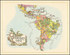
|
||

|

|
|

|
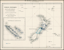
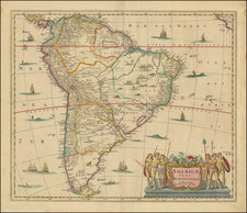
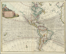
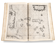
Scarce map of America, one of the earliest to illustrate the Sea of the West. Includes an interesting treatment of Florida as an Archipelago, nice detail in California and the Mississippi Valley. Also and interesting projection of New Zealand and location of many Islands in the Pacific, many of which are either fanciful or badly misplace. Nolin dedicates this map to Monseigneur LAW controlleur general des finances. John Law was a Scottish financier, who was masterminding the economic recovery of France, one element of his plan being the exploitation of the French possessions in Louisiana, the so-called Mississippi scheme, which was briefly successful and set off a wild period of speculation, before the Mississippi Bubble burst. Law fled to Venice in disgrace, but not before creating one of the first speculative booms based upon American real estate. A nice example in rich colors. Only the second time we have had the map in the past 15 years.
Jean-Baptiste Nolin (ca. 1657-1708) was a French engraver who worked at the turn of the eighteenth century. Initially trained by Francois de Poilly, his artistic skills caught the eye of Vincenzo Coronelli when the latter was working in France. Coronelli encouraged the young Nolin to engrave his own maps, which he began to do.
Whereas Nolin was a skilled engraver, he was not an original geographer. He also had a flair for business, adopting monikers like the Geographer to the Duke of Orelans and Engerver to King XIV. He, like many of his contemporaries, borrowed liberally from existing maps. In Nolin’s case, he depended especially on the works of Coronelli and Jean-Nicholas de Tralage, the Sieur de Tillemon. This practice eventually caught Nolin in one of the largest geography scandals of the eighteenth century.
In 1700, Nolin published a large world map which was seen by Claude Delisle, father of the premier mapmaker of his age, Guillaume Delisle. Claude recognized Nolin’s map as being based in part on his son’s work. Guillaume had been working on a manuscript globe for Louis Boucherat, the chancellor of France, with exclusive information about the shape of California and the mouth of the Mississippi River. This information was printed on Nolin’s map. The court ruled in the Delisles’ favor after six years. Nolin had to stop producing that map, but he continued to make others.
Calling Nolin a plagiarist is unfair, as he was engaged in a practice that practically every geographer adopted at the time. Sources were few and copyright laws weak or nonexistent. Nolin’s maps are engraved with considerable skill and are aesthetically engaging.
Nolin’s son, also Jean-Baptiste (1686-1762), continued his father’s business.