|
||

|

|
|

|
Gorgeous coastal chart, extending from Dunkerque and Wynoxbergen to in the east to Waldarn and Gravelines in the west, with an inset showing the continuation of the coast to Calais. The map illustrates approximately 30 ships off the coastline and various coastal features. The map is based upon a chart prepared by Pieter Codde, a captain who lived in Enkhuizen. Dutch text on the verso. Very decorative.
Willem Janszoon Blaeu (1571-1638) was a prominent Dutch geographer and publisher. Born the son of a herring merchant, Blaeu chose not fish but mathematics and astronomy for his focus. He studied with the famous Danish astronomer Tycho Brahe, with whom he honed his instrument and globe making skills. Blaeu set up shop in Amsterdam, where he sold instruments and globes, published maps, and edited the works of intellectuals like Descartes and Hugo Grotius. In 1635, he released his atlas, Theatrum Orbis Terrarum, sive, Atlas novus.
Willem died in 1638. He had two sons, Cornelis (1610-1648) and Joan (1596-1673). Joan trained as a lawyer, but joined his father’s business rather than practice. After his father’s death, the brothers took over their father’s shop and Joan took on his work as hydrographer to the Dutch East India Company. Later in life, Joan would modify and greatly expand his father’s Atlas novus, eventually releasing his masterpiece, the Atlas maior, between 1662 and 1672.
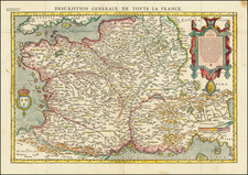
![[ France ] Galliae Regionis Nova Descriptio](https://storage.googleapis.com/raremaps/img/small/81285.jpg)

![Europe No. 16. Partie De La Russie D'Europe [Tambow, Woroniege, Saratow and Territoire De La Milice De Don, etc.]](https://storage.googleapis.com/raremaps/img/small/19823.jpg)
![[Course of the Rhine River] Nova Tractus Totius Rheni Oder Neue beschreibung des Rhein-Strom](https://storage.googleapis.com/raremaps/img/small/58670.jpg)