The item illustrated and described below is sold, but we
have another example in stock. To view the example which
is currently being offered for sale, click the
"View Details" button below.
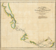
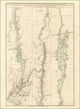
1828 Sir John Franklin / Ed Kendall
$ 345.00


|
||

|

|
|

|
Stock# 12105
Description
Scarce map of the route of the British explorers from Fort William on Lake Superior to Lake Winnepeg, during Franklin's explorations of the Polar regions of Canada. The map accompanied the first edition of Franklin's Narrative of his second expedition to the Arctic. Highly detailed map, including many place names and field notes, topographical details, Indian Names etc.. An important milestone in the exploration of the region and pursuit of the Northwest Passage. A few minor fold splits, but generally a very nice example.