|
||

|

|
|

|
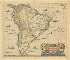
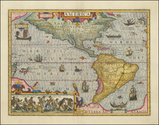
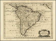
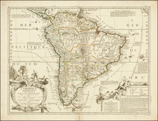
Detailed map of the Atlantic Ocean and contiguous coasts, used by Vander Aa to illustrate a Dutch Translation of Antony Knivet's Voyage. In all, Vander Aa issued 130 translations of important 15th, 16th and 17th Century Travel Narratives to the America, Africa and Asia, which were issued in 28 volumes in the early part of the 18th Century. Many of the narratives are either unobtainable or extremely rare in their original formats. Striking full color example of this beautifully engraved map.
Pieter van der Aa (1659-1733) was a Dutch mapmaker and publisher who printed pirated editions of foreign bestsellers and illustrated books, but is best known for his voluminous output of maps and atlases. Van der Aa was born to a German stonecutter from Holstein. Interestingly, all three van der Aa sons came to be involved in the printing business. Hildebrand was a copper engraver and Boudewyn was a printer.