


|
||

|

|
|

|
John White's manuscript of Virginia, engraved by De Bry for his Anglorum in Virginiam aduentus, is one of the most significant cartographic milestones in colonial North American history.
Theodore de Bry's map of Virginia, after John White, is one of the most significant cartographical milestones in colonial North American history. It was the most accurate map drawn in the sixteenth century of any part of that continent. It became the prototype of the area long after James Moxon's map in 1671. The region of Chesapeake Bay was, however, improved by the surveying of John Smiths around 1607. This is the first map to focus on Virginia (now largely North Carolina), and records the first English attempts at colonisation in the New World.
Burden states
The map concerned depicts the area from Chesapeake Bay to Cape Lookout. It exhibits greater knowledge than on any of the surviving manuscripts. Possibly this is from knowledge gained during White's brief visit in 1587 and signifies some lost manuscripts. Here we find the first printed use of the name Chesapeake, Chesepiooc Sinus, and the second of Roanoke (the first being Mazza). It depicts the positions of the Indian villages in the area and is adorned with the Royal Arms of England. The Latter's ships are shown at sea with Indian canoes traversing the inland waters. The two native scenes shown are taken from illustrations in the book. It influenced many maps, most notably those of de Jode 1593, Wytfliet 1597 and Metellus 1598. There are three states of the map, this is the second one with a 'C' superimposed on the first letter of the village called Ehesepiooc
Cumming comments
Although this map lacks the authenticity of White's manuscript map of approximately the same area, the addition of some names and an improvement in coastal delineation may show increased knowledge gaines in 1587-88, after the manuscript map was made. De Bry's engraving of White's watercolor map is one of the most important type maps in Carolina cartography.
Stephenson & McKee states:
The new geographical information imparted by the White-de Bry engraving swept through Europe and was incorporated into maps by other publishers for at least eighty years. Roanoke Island, neighboring Indian villages, and other features are identified. In addition, the entrance to the Chesapeake Bay, Chesepiooc Sinus, is named for the first time on a published map. De Bry oriented White's map to show west at the top rather than north. This became the preferred orientation for published maps of Virginia and other eastern seaboard colonies until the eighteenth century.
Theodor de Bry (1528-1598) was a prominent Flemish engraver and publisher best known for his engravings of the New World. Born in Liege, de Bry hailed from the portion of Flanders then controlled by Spain. The de Brys were a family of jewelers and engravers, and young Theodor was trained in those artisanal trades.
As a Lutheran, however, his life and livelihood were threatened when the Spanish Inquisition cracked down on non-Catholics. De Bry was banished and his goods seized in 1570. He fled to Strasbourg, where he studied under the Huguenot engraver Etienne Delaune. He also traveled to Antwerp, London, and Frankfurt, where he settled with his family.
In 1590, de Bry began to publish his Les Grands Voyages, which would eventually stretch to thirty volumes released by de Bry and his two sons. The volumes contained not only important engraved images of the New World, the first many had seen of the geographic novelties, but also several important maps. He also published a collection focused on India Orientalis. Les Grands Voyages was published in German, Latin, French, and English, extending de Bry’s fame and his view of the New World.

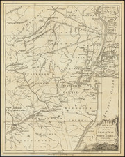
![(Civil War) Stanford's Map of the Seat of War in America. Sheet I. [Mid-Atlantic States]](https://storage.googleapis.com/raremaps/img/small/96007.jpg)

![A New Map of Virginia [Chesapeake]](https://storage.googleapis.com/raremaps/img/small/43053.jpg)
