This item has been sold, but you can enter your email address to be notified if another example becomes available.


|
||

|

|
|

|
Stock# 10136
Description
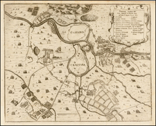
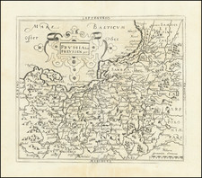
Very scarce regional map of Poland and the Ukraine, showing the region travesed by the Weschel River from Cracow to Warsaw.
Shows rivers, roads, towns, castles, forests, lakes and a host of other details. One of the most detailed maps of this region to appear in an 18th Century Atlas.
From Von Reilly's Grosser Deutscher Atlas. Von Reilley & Schaembl led a revival of map making in Vienna in the late 18th Century which included this and several other sought after works.
![[ Warsaw to Krakow ] Der Koniglichen Republik Polen Woiwodschaften Krakuw u Sanomir mit dem untern Teile der Woiwodschaft Lublin undd dem Herzogthme Severein oder Klein Polen westlicher Theil . . .](https://storage.googleapis.com/raremaps/img/small/103028.jpg)