The item illustrated and described below is sold, but we
have another example in stock. To view the example which
is currently being offered for sale, click the
"View Details" button below.


|
||

|

|
|

|
Stock# 0792
Description
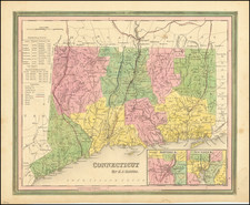
Marvelous example of Tanner's map, with insets of Hartford and New Haven. The map is hand colored by counties, and shows towns, roads with distances, steam and stage routes, railroads, canals, and a host of other details. Statistical tables provides populations by counties and historical information dating back to 1701. Tanner's maps rarely appears on the market. A nice wide margined example.
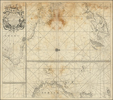
![[ Large Cape Cod Inset ] The River & Gulf of St. Lawrence, Newfoundland, Nova Scotia, and The Banks Adjacent, From The English Admiralty & French Marine Surveys. . . . 1844. Additions To 1857.](https://storage.googleapis.com/raremaps/img/small/85637.jpg)
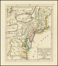
![[Right sheet only of: A New Chart of America Florida to New York with the Principal Harbours on a Large Scale, Drawn from the latest Authorities, by Robt Blachford. 1807.]](https://storage.googleapis.com/raremaps/img/small/55819.jpg)