|
||

|

|
|

|
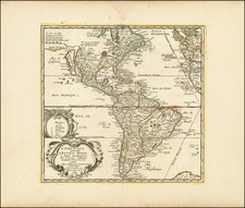
Rare separately issued map of America, not intended to be issued in any atlas although occaisonally appearing in Doncker's Zee-Atlas. The map is an amalgam of sources. The figures derive from the rare and desireable 1614 Van den Keere, but w/fewer town illustrations. The California model is after Luke Foxe, but the continguous coast of the mainland is inadvertently engraved as a river. Hudson's Bay & the Great Lakes are derived from Blaeu. New Amsterdam is shown, but no evidence of English settlements. The map is based upon Dutch sources, despite the availability of more contemporary French material. Two Virginia figures are among the 8 shown. Expertly mended tear & minor repairs at centerfold. A striking example. Burden 356, McLaughlin 24.
De Wit (1629 ca.-1706) was a mapmaker and mapseller who was born in Gouda but who worked and died in Amsterdam. He moved to the city in 1648, where he opened a printing operation under the name of The Three Crabs; later, he changed the name of his shop to The White Chart. From the 1660s onward, he published atlases with a variety of maps; he is best known for these atlases and his Dutch town maps. After Frederik’s death in 1706, his wife Maria ran the shop for four years before selling it. Their son, Franciscus, was a stockfish merchant and had no interest in the map shop. At the auction to liquidate the de Wit stock, most of the plates went to Pieter Mortier, whose firm eventually became Covens & Mortier, one of the biggest cartography houses of the eighteenth century.
![[ Patagonia / Chile / Argentina ] A New Map of the Southern Parts of America taken from Manuscript Maps made in the Country and a Survey of the Eastern Coast made by Order of the King of Spain.](https://storage.googleapis.com/raremaps/img/small/100772.jpg)
![[Portrait of Amerigo Vespucci] America Meridionale . . . 1823](https://storage.googleapis.com/raremaps/img/small/75917.jpg)